Exploration & Technical Highlights
2026 Field Program
Historical Exploration
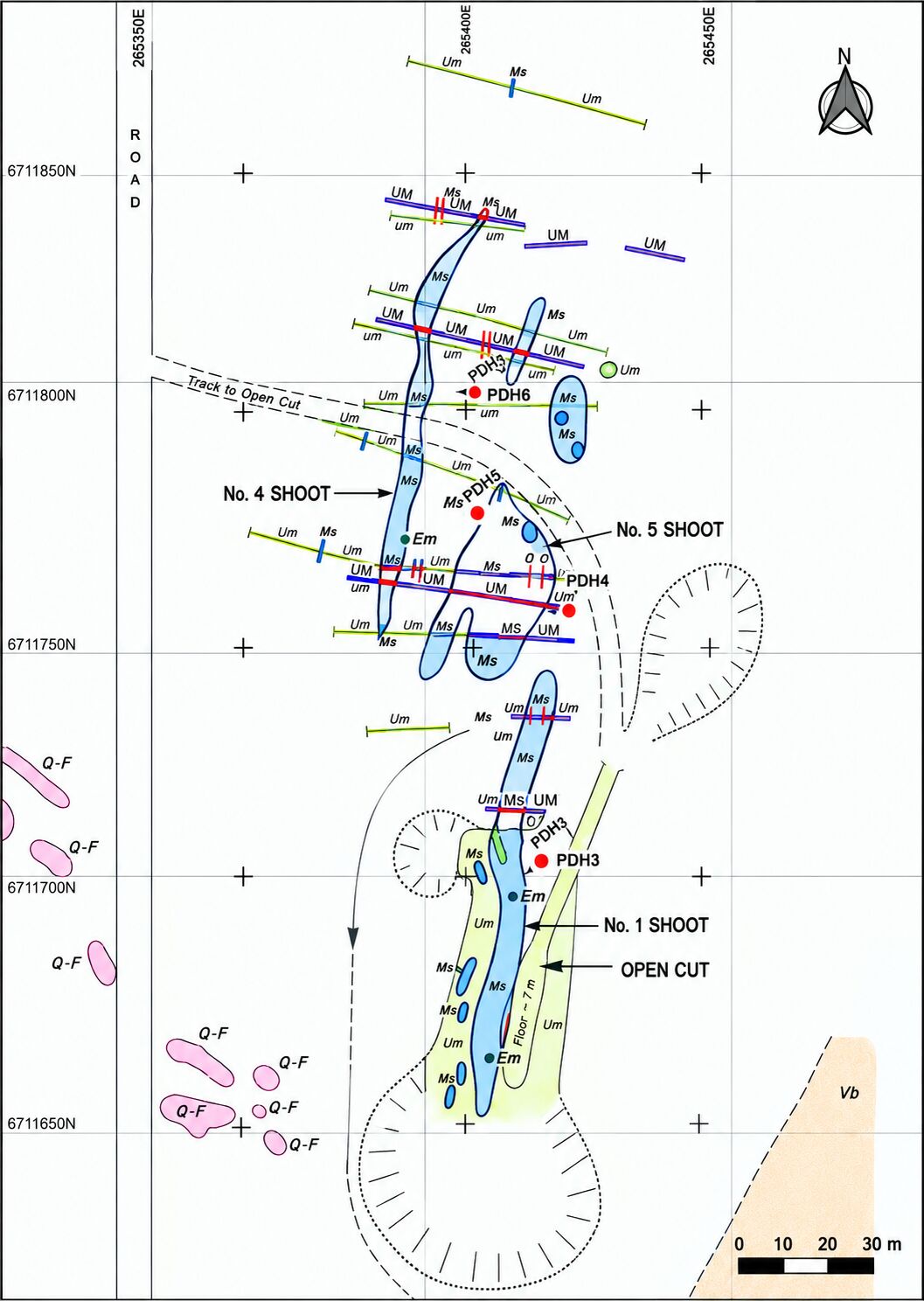
The only recorded historical exploration on the Menzies Emerald Project was undertaken by North Kalgurli Mines Limited between 1979 and 1982, including costeaning, trenching, geological mapping and seven rotary percussion drill holes.
Costeaning & Geological Mapping
Work concentrated on the known emerald-bearing zones. Geological mapping recorded the distribution of black mica schist shoots and provided the basis for subsequent drill targeting.
1980 Rotary Percussion Drilling
Seven holes, most drilled to approximately 35 m, targeted Shoots 1, 2, 4 and 5 to test the continuation of mica schist beneath surface workings. Drilling indicated that selected shoots persist below surface, with green beryl reported at depth in several intersections.
Key Historical Conclusions
- Mica schist shoots dip approximately 65° to the east
- Shoots 1 and 2 were interpreted to persist to approximately 20–35 m vertical depth
- Green beryl was reported at these depths
2026 Exploration Highlights
Gemstar’s 2026 field program tested known and interpreted mica schist zones across the Mining Lease and established new tools for target generation.
Trenching
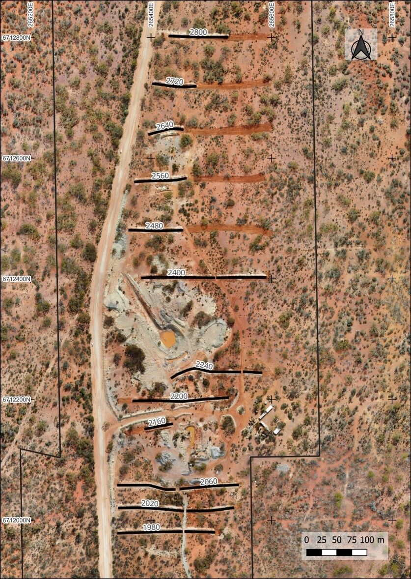
12 trenches completed across the Project area, seeking extensions of known mica schist occurrences and examining the potential mineralisation corridor.
New Discovery
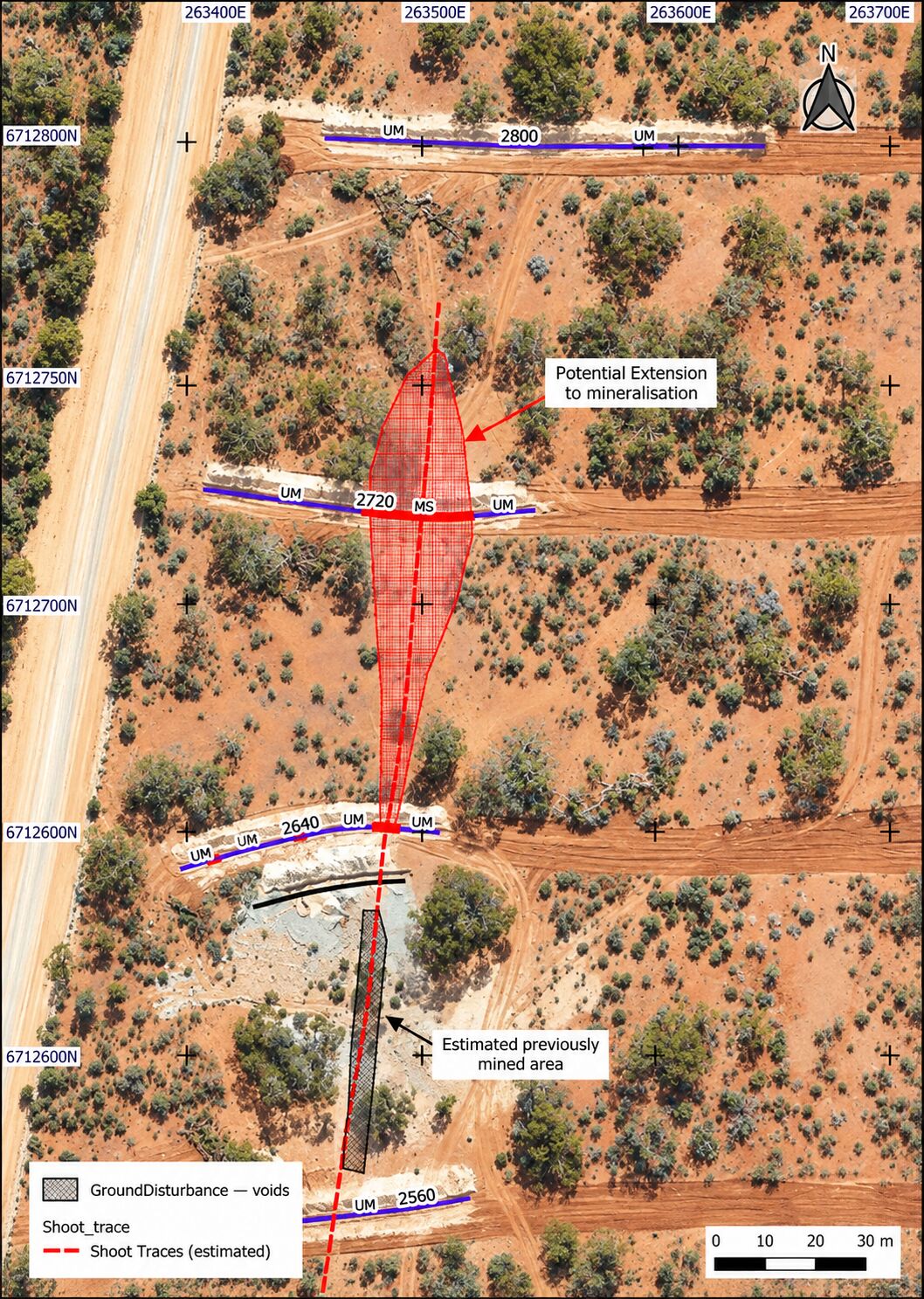
A new mica schist zone approximately 26 m wide was identified at Trench 2720, in the north of the Mining Lease.
Soil Geochemistry
An orientation soil geochemistry program was completed immediately north of Trench 2720.
Drone Survey
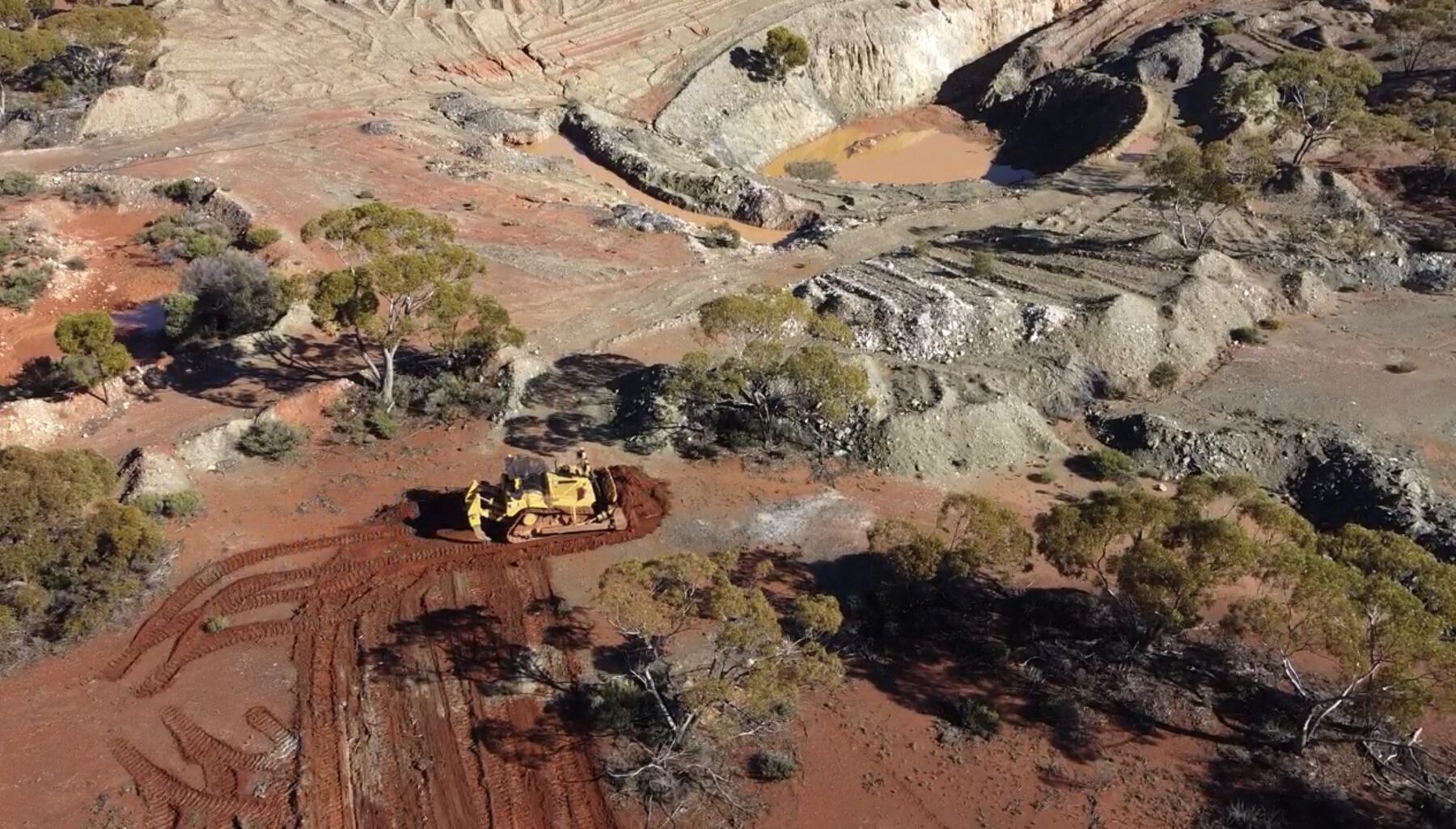
Drone orthophotography and terrain modelling were completed before and after trenching, providing a base map and a record of ground disturbance.
Trench 2720 – 26 m Mica Schist Zone
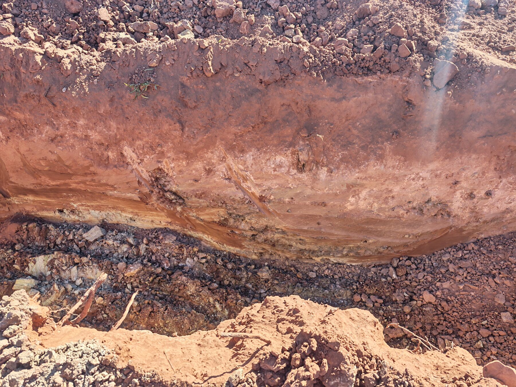
Most trenches intersected only minor mica schist occurrences. However, Trench 2720, the second most northerly trench completed during the program, identified a significant new mica schist zone approximately 26 m wide.
The next trench to the north, Trench 2800, did not intersect mica schist, providing an important constraint on the interpreted extent of mineralisation in that direction.
The newly identified zone represents an important addition to the known mineralised system in the northern part of the Mining Lease. It has not yet been fully explored, and further work is required to determine its extent, continuity and emerald mineralisation.
Trench 2720 materially extends the known mica schist system to the north and remains a priority for follow-up exploration.
Orientation Soil Sampling
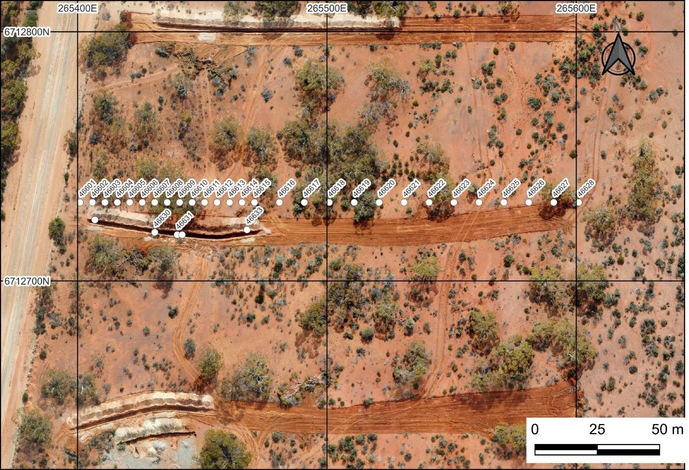
A soil geochemistry orientation survey was completed immediately north of Trench 2720, in undisturbed ground, to evaluate surface geochemical responses associated with mica schist and to support broader target generation across the Mining Lease.
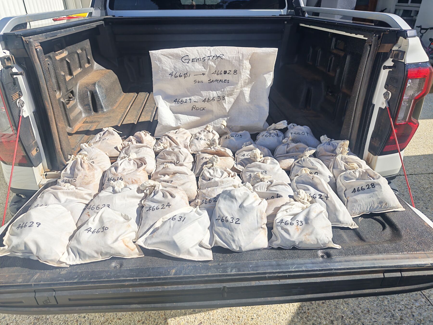
The program combined 28 soil samples, collected from 1–10 cm depth, with five rock control samples from trench spoil, providing a direct comparison between surface geochemical signatures and known mica schist material. Samples were assayed by Intertek in Perth.
Results confirmed a positive geochemical response associated with the Trench 2720 mica schist zone. The black mica schist carries a distinctive signature, and in soil this is best expressed by lithium, supported by rubidium, caesium and thallium, with the highest values recorded directly over the schist.
The orientation program demonstrated that soil geochemistry can assist in identifying concealed or previously unrecognised mica schist occurrences, and supports the expansion of systematic soil sampling as a target-generation tool.
Priority Exploration Targets
Northern Exploration Areas
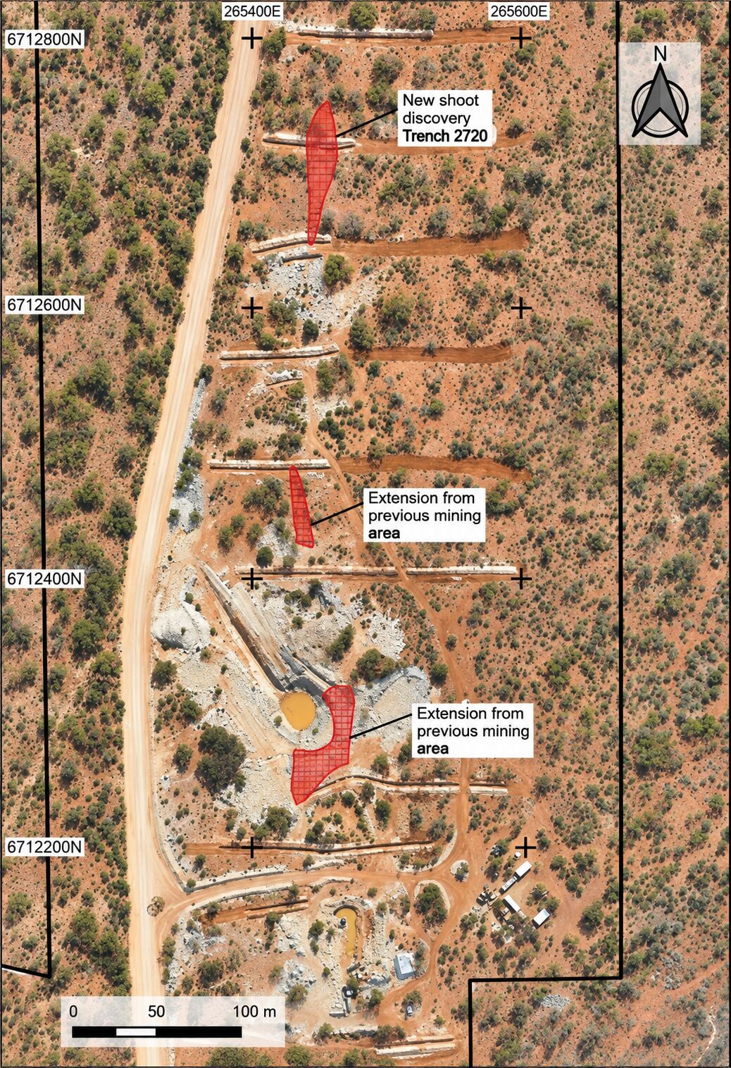
Initial exploration is proposed across the northern part of the Mining Lease, including the newly identified mica schist occurrence in the Trench 2720 area and other potential targets generated through soil geochemistry. Follow-up work will focus on trenching and delineation of previously untested mica schist occurrences.
Main Pit & Known Shoots
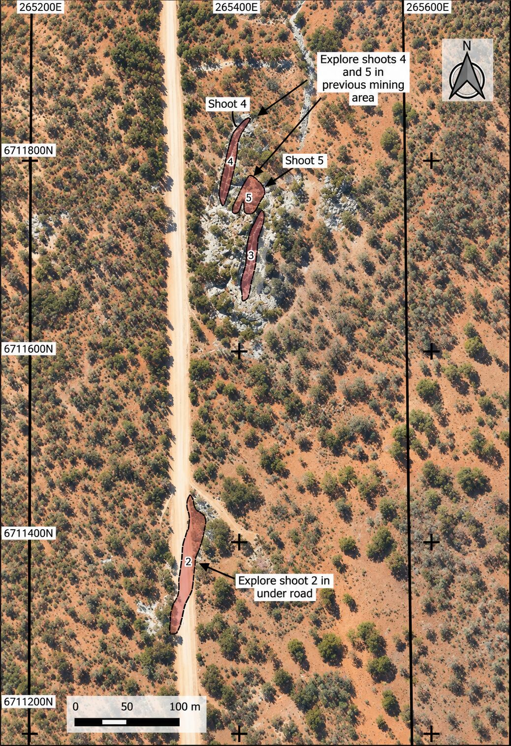
Exploration is proposed around the main pit area, including extensions of known mica schist shoots and areas previously affected by shallow historical mining. Shoots 4 and 5 have been mined historically but retain significant mapped widths and remain priority areas for further evaluation.
A Clear Five-Stage Pathway
Gemstar is advancing the Menzies Emerald Project through a five-stage exploration and technical development strategy focused on target generation, delineation, grade definition, valuation and process optimisation.
Target Generation
Systematic soil geochemistry across the Mining Lease to identify new shoots, and to test the lease’s gold potential.
Delineation
Trenching and extension of known shoots, and excavation of the new shoot at Trench 2720.
Grade Definition
Systematic bulk sampling to obtain grade estimates for individual shoots.
Valuation
Gemmological evaluation, quality classification and pricing of recovered emeralds.
Process Metallurgy
Liberation studies and flowsheet optimisation for emerald recovery.
The Menzies Emerald Project is an advanced exploration project. While emerald mineralisation has been demonstrated historically and through recent exploration activities, the economic feasibility of extracting emeralds from the Project has not yet been established. No Mineral Resource or Ore Reserve has been estimated.